

This week, Jared Bowen gives us a look at what the Front Porch Arts Collective is doing virtually for Juneteenth. Plus, a new online exhibition that looks at how maps and visual data are used to manipulate information.
The Front Porch Arts Collective celebrates Juneteenth with a collection of digital events presented through June 20
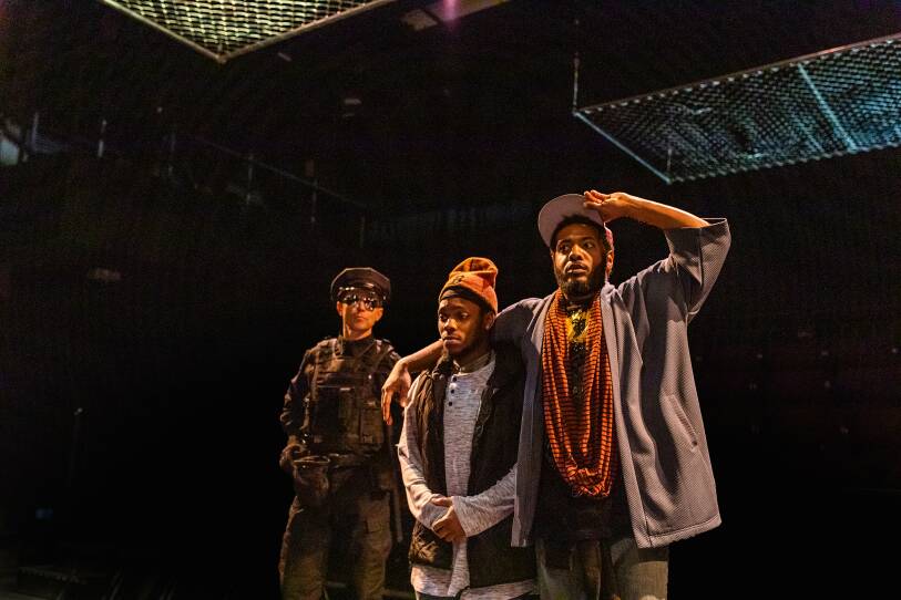
“You can’t escape the images of black suffering and black death, and the ways that systemic racism has injured our physical bodies, our spirits, and increased pain, particularly right now in our daily lives,” says Front Porch Arts Collective Co-founder and Executive Director Maurice Parent.
In response to the killings of black men and women across the United States, this Juneteenth, the Front Porch Arts Collective has partnered with a host of artists and organizations for a 10-day virtual arts festival celebrating and highlighting the work of artists of color. Upcoming events include poetry readings, music performances, short plays, and acting seminars in the Greater Boston area.
Friday’s programming features a variety of events cohosted by institutions like Porter Square Books and the Museum of Fine Arts, and will culminate with “Stop & Frisk: A Juneteenth Poetry Reading” celebrating the launch of Jabari Asim’s latest book and hosted on CrowdSource by Boston Poet Laureate, Porsha Olayiwola.
“Bending Lines: Maps And Data From Distortion To Deception,” presented online by the Norman B. Leventhal Map and Education Center and the Boston Public Library
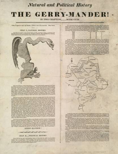
You will never read a map the same way again after seeing “Bending Lines: Maps and Data from Distortion to Deception.”
Using historic maps and data chiefly from the Boston Public Library, the Norman B. Leventhal Map and Education Center presents this new, virtual exhibition examining how maps have historically been employed as powers of persuasion — thereby creating an altered perception of the world. From a 16th-century Ptolemaic map to Donald Trump’s “Sharpie-enhanced” map of Hurricane Dorian’s path, the exhibition highlights unique and specific examples of how cartography can be used to push narratives of authority that aren’t necessarily always true to life.
“Every map is trying to make an argument about the world,” says Leventhal Map Center Curator and Director of Geographic Scholarship, Garrett Dash Nelson. “What we want people to think when they look at these maps is what am I trying to be persuaded of?” Works from this exhibition are currently available online, with plans for a physical exhibition at a to-be-determined date once the Boston Public Library has fully reopened to the public.
Are you celebrating Juneteenth in a creative way? Tell Jared about it on Facebook or Twitter!


