


GBH's Morning Edition asked our audience for weather and gardening questions, and meteorologist Dave Epstein graciously answered them on the air. This transcript has been edited for clarity.
Have a gardening or weather question for meteorologist Dave Epstein? Tweet him @GrowingWisdom, email us at thewakeup@wgbh.org, or text 617-300-2008.
Is this month abnormally warm so far? What does that mean?


This January has indeed been warmer than usual, though not the warmest on record, Epstein said.
“I've been digging into my database, and right now we're running the third-warmest January on record,” he said. “I do think that number is going to fall a little bit. We're not going to end up with the warmest, the warmest was back in 1913, but we've had only one day below average here this month so far.”
On average, Boston is running about 7.7 degrees warmer than the average January temperature this month.
While a two-week stretch of warm weather is not in itself proof of climate change, a warming climate does mean warm Januarys are more likely.
“We haven't had one day stay under freezing the entire day,” Epstein said. “That's pretty remarkable. And we also have not had any days where Boston has gone below 20 degrees at night.”
My kids want to know: When can they go sledding again? –GBH’s Morning Edition Executive Producer Karen Marshall
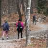
Monday’s snow was far from record-breaking, measuring just 3.5 inches at Logan Airport. But it allowed some kids to sled, make snow angels and enjoy the winter weather.
“Right now, it looks like if you're in northern sections of Massachusetts, the snow will return a little bit here for Thursday night and Friday,” Epstein said. Those areas can expect about two to five inches of snow, though that may change.
Greater Boston likely won’t see any snow at all on those days, Epstein said. But more systems that could bring snow to Boston are coming.
“We've got another storm system coming in here for Sunday night and Monday, and another storm system coming in on Wednesday,” Epstein said. “We're in a very active pattern — three storms here over the next seven days.”
The cape & islands, towns along the southern NH border & a strip around Hampshire county is abnormally dry will the lack of snow and cold heighten drought conditions or keep it steady?
— Dr. Laura A. De Veau 🐝🛤 (@deveautrain) January 18, 2023
The drought of summer 2022 has passed, Epstein said, and winter dryness likely won’t cause another one.
“If we don't see precipitation over the course of the winter, obviously then we get into problems for the spring. But right now, in terms of drought, we don't have any drought anywhere in New England,” he said.
The lack of precipitation is “a little unusual, but nothing I would be concerned with,” Epstein said. “I think we really have to wait and see what things look like in April and May.”
When is the right time and method to trim large ornamental grasses? —Penny
The relative dearth of snow this year means tall ornamental grasses may still be looking pretty good, Epstein said.
“You can do them almost at any time,” he said. “What I tend to do is just kind of leave them until they get a heavy, wet snow and then flop down. But the best time, I think, if you don't want to leave them for the winter, is first thing in the spring, as soon as you can get back into the ground. Just cut them back all the way and then they will start coming up in April or May, depending on the variety you got.”
I wrote just this morning about my concerns that this early mild weather may affect maple sugaring season. Curious to hear Dave's take on it.
— Heath Racela (@HeathRacela) January 18, 2023
Here's what I wrote: https://t.co/AhsqsuOVFX
For maple sugaring season, Epstein said, it’s helpful to have above-freezing days and below-freezing nights. Even with a warmer than usual January, it’s still too early to see active sap running through maple trees.
“But if this pattern, let's say, continued into February, you'd have an early sap season,” Epstein said. “I do think that we're going to trend quite a bit colder here at the end of the month, and I think the beginning of February also looks colder than average. So the season right now, we're not going to start any earlier than it typically does.”
In other words — right now, the maple season is looking fine, he said.
What’s the different between snow, sleet and freezing rain?
Good question from @jersiegel this morning. #weatherwisdom https://t.co/hIdCXhQtI6 pic.twitter.com/AJ1sLJQsvg
— Dave Epstein (@growingwisdom) January 18, 2023
All are forms of precipitation formed in below-freezing conditions. The difference has to do with a process called inversion, Epstein said.
“Picture a snowflake coming out of a cloud,” Epstein said. That snowflake will stay intact only if it encounters below-freezing temperatures all the way from the cloud to the ground.
But with inversion, it encounters warmer air and melts into a raindrop, Epstein said.
Three things can then happen: If the drop sees above-freezing temperatures all the way to the ground, it will stay rain.
“If it's cold high up, then that little raindrop will refreeze into a pellet of ice and hits you as sleet, those little balls of ice we see in the winter,” Epstein said. “If the cold is shallow as it comes down, it doesn't freeze, it stays liquid. But the second it hits your car windshield, the trees, the sidewalk, it freezes, and that's freezing rain.”
“It never can go back to snow, though, no matter how cold it is,” Epstein said. “Once that flake melts, it's done.”


